Geotagging setup
In order to be able to complete Unit I you will need to:
-
download and setup Geosetter, a specialised freeware for editing image metadata and geotagging. Available at:
http://www.geosetter.de/en/download/
Geosetter has been developed for Windows Operating systems. To run Geosetter on an Apple Macintosh computer, the Mac must be set up to run Windows by following one of two installation options:
Option 1 : Create a dual-boot setup on your Mac. This allows you to boot into either Mac OS or Windows OS. The usual way to do this is to use the free software BootCamp. Available at: http://www.apple.com/support/bootcamp/
Option 2 : Create a virtual machine on your Mac. This allows you to run an installation of Windows OS in parallel with your existing Mac OS, and to seamlessly switch between the two. Typical choices for the virtualization option are the licensed software Parallels or VMware.
-
open a free account on Geonames geographical database
-
download and unzip the folder 'tutorial_resources _1'
Geosetter setup
Run the executable file geosetter.setup(.exe) and follow the instructions in the wizard. Once the programme runs, firstly you will be prompted to configure the settings.
Start from File Options tab. In the list shown to the left select the file type 'JPEG'. The parameters we define on the right side will apply only to this type of files. On the right, check the boxes as they appear in Fig 1. The chosen options will allow you both to store your metadata in a sidecar file as well as embed them in the file itself to avoid problems that occur when metadata are stored separately (see note 1 and 2).
Figure 1. File options setup.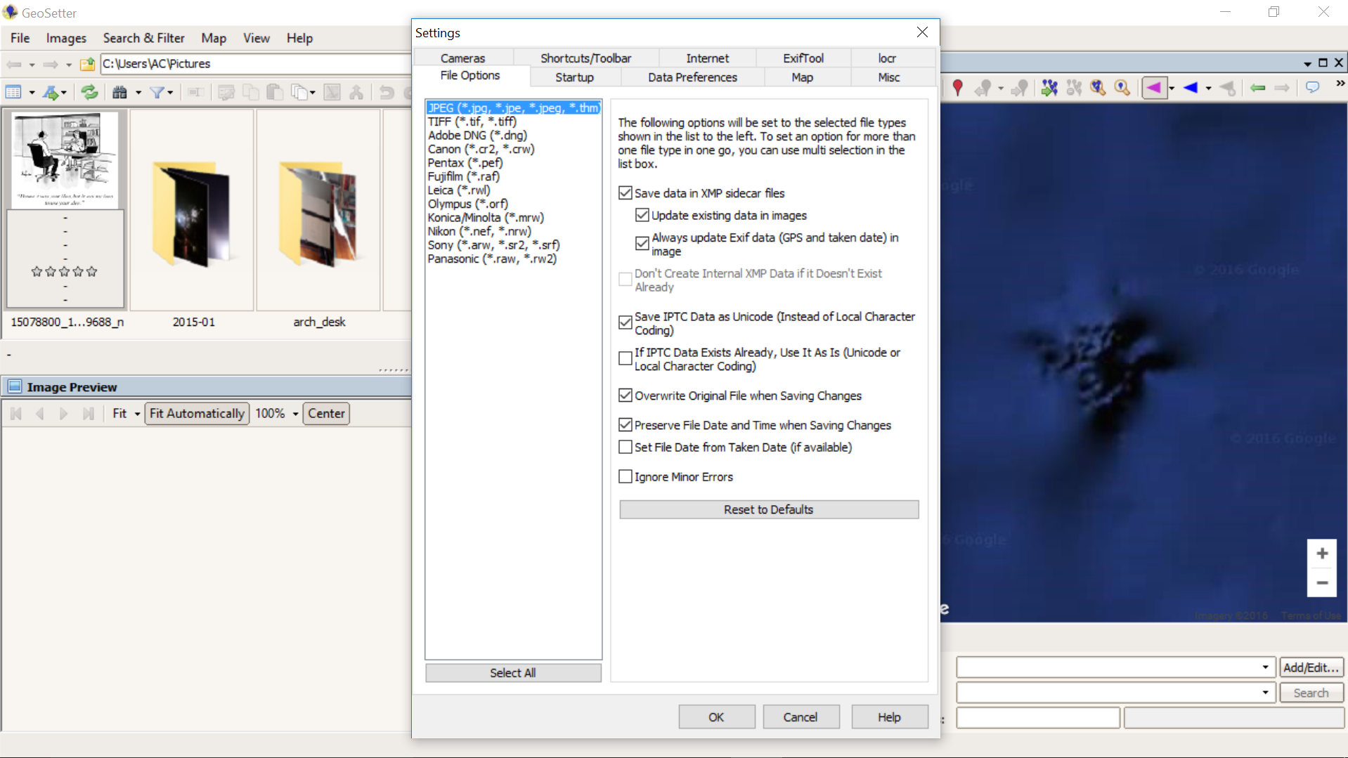
On the Startup tab select the directory of the image folder you are going to use for this exercise. Note that it is a good practice to use a copy of the files to avoid overwriting the originals. This step should look like Fig 2.
Figure 2. Directory selection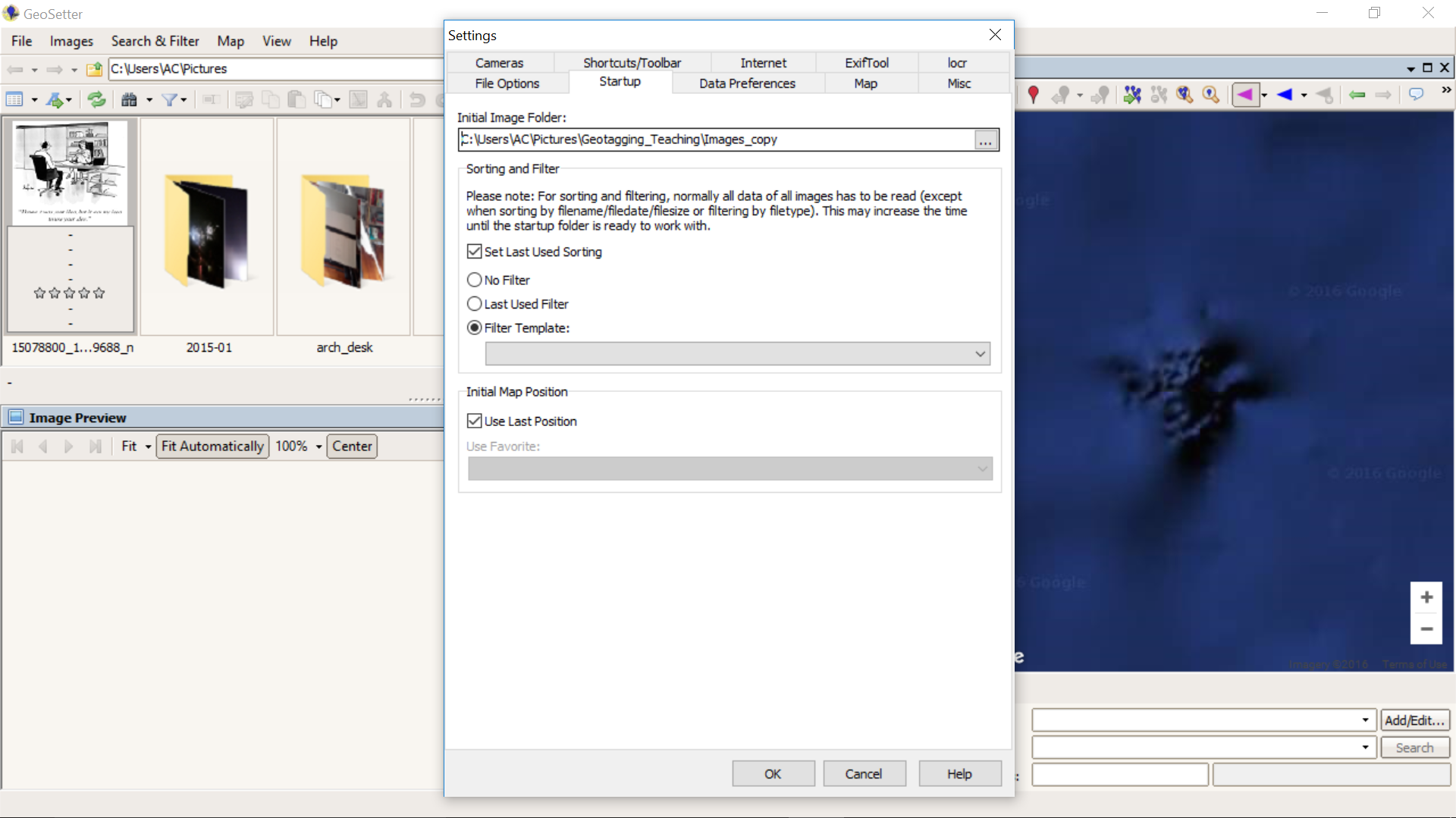
On Data Preferences set the default time zone to (UTC+02:00) Europe/Athens. Make sure the box Save GPS destination coordinates is checked. On Misc set units of measurement to Metric and Format of coordinates to Decimal.
-----------------------------------------------------------------------------------------------------------------------------------
note 1
Metadata is generally stored in two main places:
Internally – embedded in the image file, in formats such as JPEG or TIFF.
Externally – outside the image file in a Digital Asset Management (DAM) system or by a 'sidecar' file, such as the one supported by the Extensible Metadata Platform (XMP).
note 2
Regarding metadata, it falls outside the scope of this workshop to familiarise students with basic concepts and terminology. However those who wish to delve into image metadata, I recommend reading the Guidelines For Handling Image Metadata by Metadata Working Group.